![]()
InfraDoctor® is a cutting-edge system for supporting infrastructure maintenance utilizing GIS and 3D point cloud data. The system is super efficient, allowing the inspections, maintenance management, road repair and design works to be more precisely targeted.
This is also the core function of iDREAMs® which is an advanced administration system developed by Metropolitan Expressway.
Measurement Work
Measurement work utilize 3D point cloud data
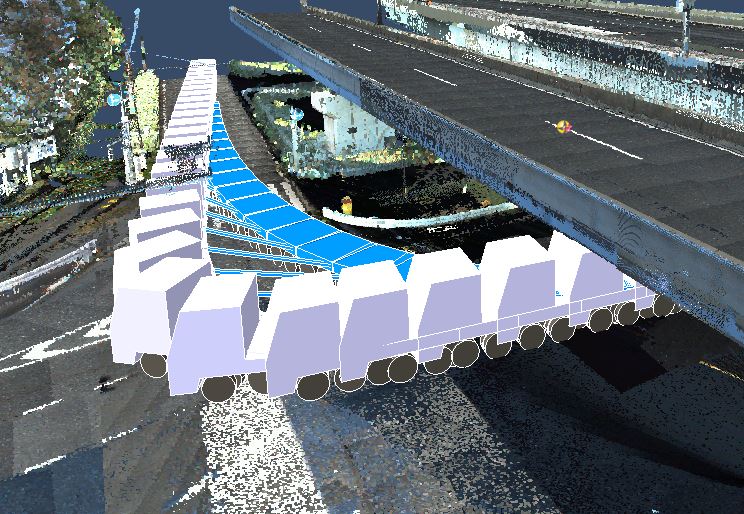
Confirming separations between adjacent structures
Utilizing to criteria for permission to pass through and work site situation of special vehicles
Driver's view simulation for driving safety
≫see detail
Confirming separations between adjacent structures
Utilizing to criteria for permission to pass through and work site situation of special vehicles
Driver's view simulation for driving safety
≫see detail
Inspection and Maintenance Work
Effective follow-up observations
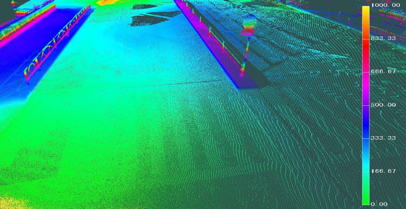
Detecting rising and stripping damege on the concrete wall
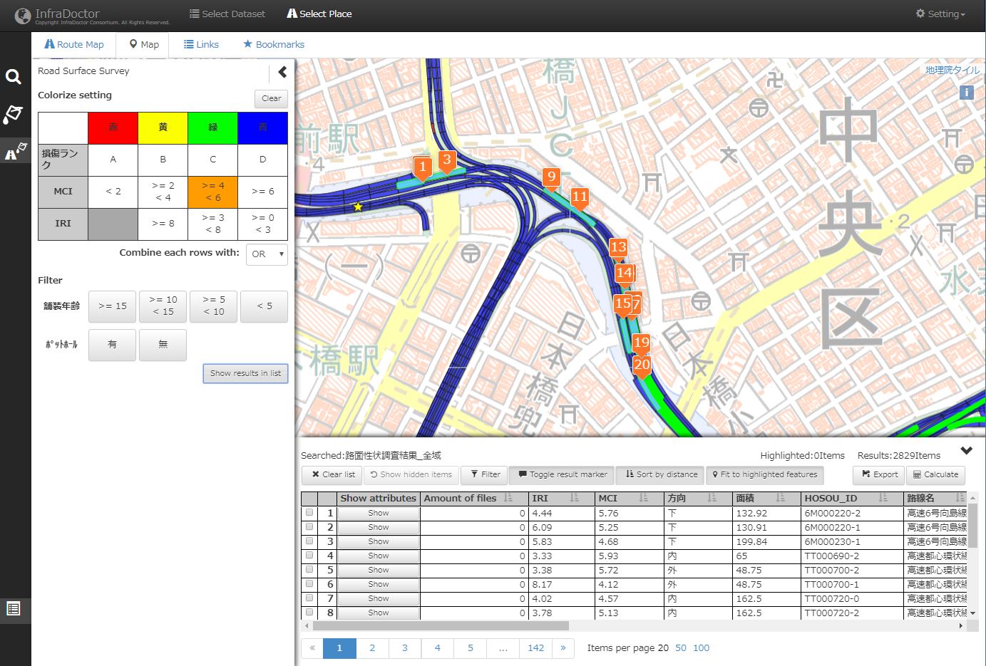
Analysis of road surfaces deformation
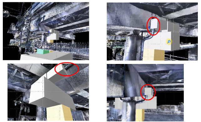
Detecting deformation by inclination and movement of structures
Effectively using and updating ledgers
≫see detail
Detecting rising and stripping damege on the concrete wall
Analysis of road surfaces deformation
Detecting deformation by inclination and movement of structures
Effectively using and updating ledgers
≫see detail
CIM
Utilizing for effective management of the infrastructure products
Utilizing for examining the installation of infrastructure planning
Utilizing for 3D CAD models made with 3D point cloud data
≫see detail
Utilizing for examining the installation of infrastructure planning
Utilizing for 3D CAD models made with 3D point cloud data
≫see detail
Disaster Prevention and Reduction
Consideration of the bent height for disaster bridge
Road drainage inspection
Tsunami or flood simulation
≫see detail
Road drainage inspection
Tsunami or flood simulation
≫see detail
2025 © InfraDoctor® Official Website