![]()
InfraDoctor® is a cutting-edge system for supporting infrastructure maintenance utilizing GIS and 3D point cloud data. The system is super efficient, allowing the inspections, maintenance management, road repair and design works to be more precisely targeted.
This is also the core function of iDREAMs® which is an advanced administration system developed by Metropolitan Expressway.
Inspection and Maintenace Work
Examples of measurement and simulation using 3D point cloud data. InfraDoctor allows effective working practice far better than before.
*Avairable category depends on the laser point numbers.
Requirement: MMS speed, under 60km per hour; distance between laser and structure, under 5m
Detecting rising and stripping damage ( *additonal function )
Rquirement laser level; over one million pints
By using two different time period 3D cloud data on InfraDcotor, deformation and movement can be confirmed.
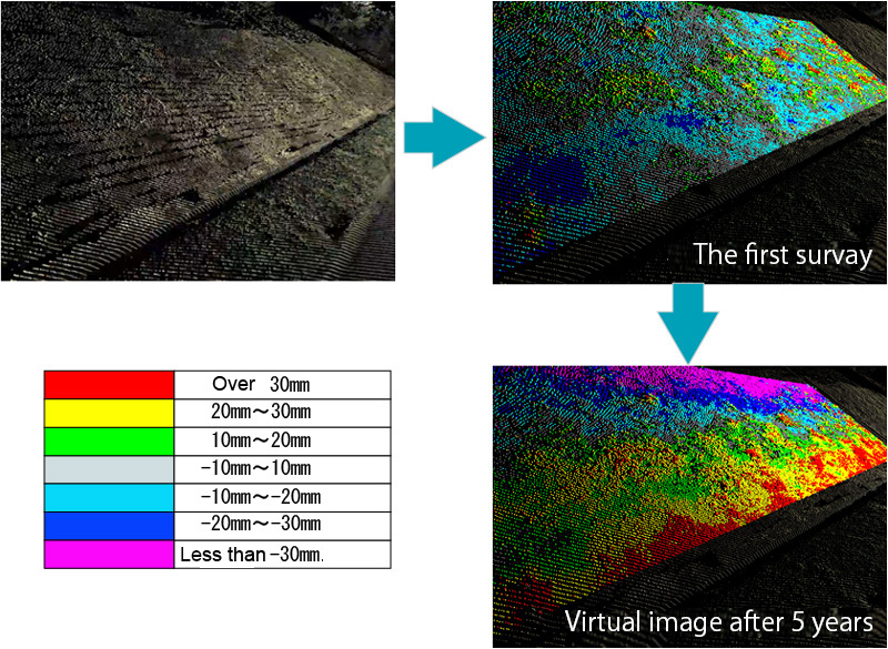
Analysis of road surfaces deformation ( *additonal function )
Rquirement laser level; over 500 thousand points
You can analyze flatness, rutting and cracking rate on the pavement surface by InfraDoctor utilizing 3D point cloud data acquired by the Mobile Mapping System (MMS) vehicle and line scan camera images.
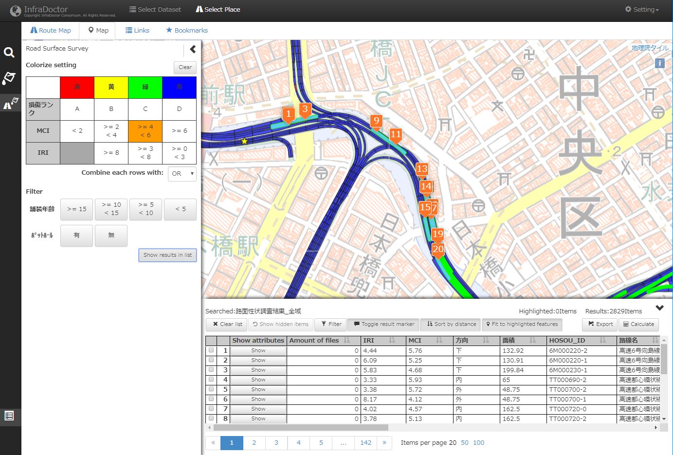
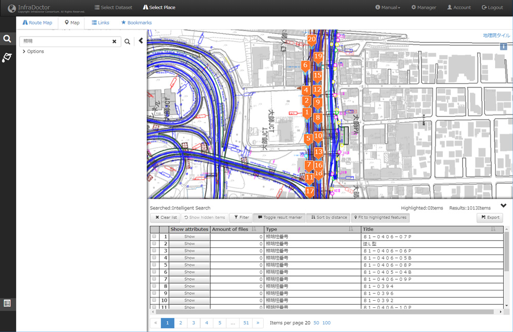
Effective ledgers usage and updates
InfraDoctor supports effective work with various ledgers on GIS platform. It makes powerful effect to decrease running costs and work time than paper ledgers.
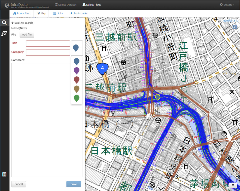
There is a function for share comments and documents on GIS.
2025 © InfraDoctor® Official Website