InfraDoctor® is a cutting-edge system for supporting infrastructure maintenance utilizing GIS and 3D point cloud data. The system is super efficient, allowing the inspections, maintenance management, road repair and design works to be more precisely targeted.
This is also the core function of iDREAMs® which is an advanced administration system developed by Metropolitan Expressway.
Comments and files share function
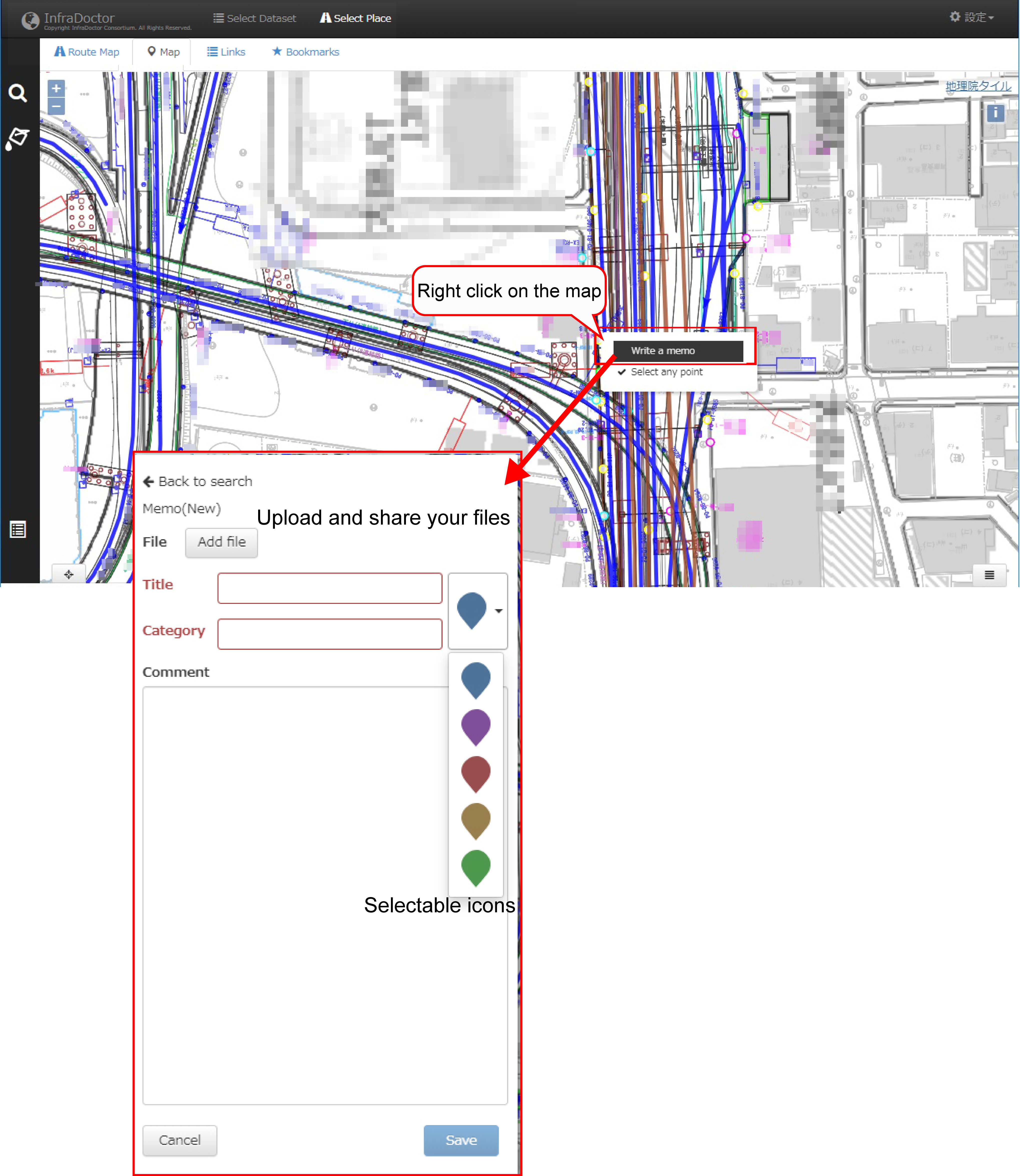
It allows users to add comments and attach files on the GIS. The added comments then appear on the map with an icon. This function makes information sharing among colleagues more efficient.
3D point cloud data and omnidirectional video image viewing
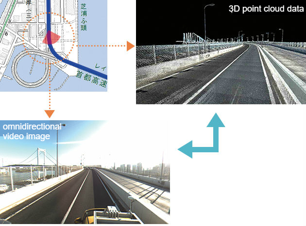
The system allows simultaneous viewing and sychronizing 3D point cloud data together with omnidirectional video images to determine roadway conditions or to pinpoint a particular location by switching data view.
Function of various ledgers on intelligent search
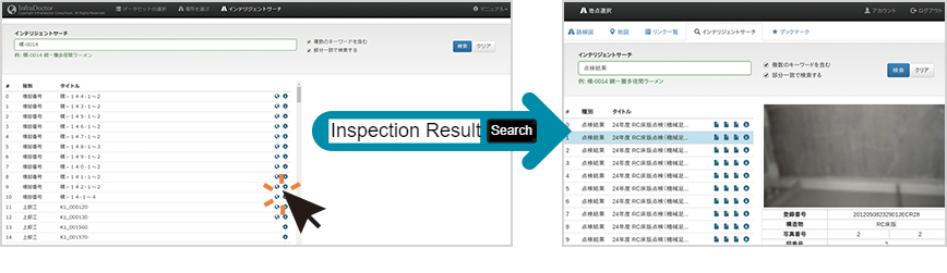
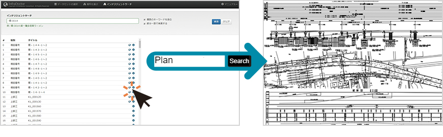
For road maintenance work, ledger data is required to be known, such as road structures, appendages and underground buried structures. InfraDoctor® provides an efficient management of ledger data by linking GIS and 3D point cloud data.
3D dimension measurement
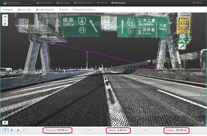
3D point data has an accurate three dimensional coordinate (X, Y and Z coordinates). This means traffic control won't be needed, for example, a traffic control designed for measurement of a cross road, closure of a railway for confirmation of construction clearance between railway and adjacent structures.
Viewing a section
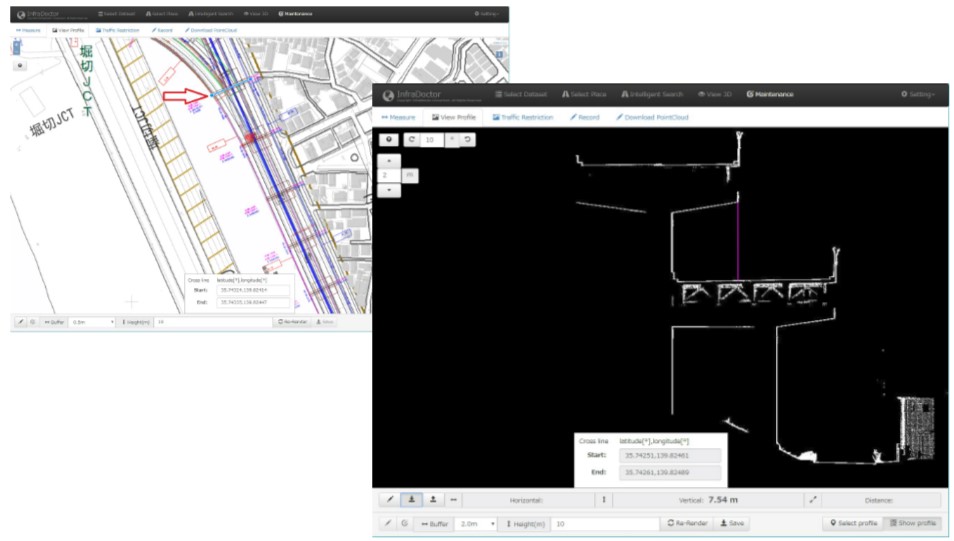
You can view a section where you set a location. And measurement calculation is also available in the section.
The function was updated!! Workload is reduced by automatic section drawing.
The function was updated!! Workload is reduced by automatic section drawing.
Making traffic control plan

InfraDoctor® help you to make traffic control plan with ease. Some control elements are mounted in the system. It is a simple operation by downloading CAD traffic control data and setting a few parameters.