InfraDoctor logo
InfraDoctor® is a cutting-edge system for supporting infrastructure maintenance utilizing GIS and 3D point cloud data. The system is super efficient, allowing the inspections, maintenance management, road repair and design works to be more precisely targeted.
This is also the core function of iDREAMs® which is an advanced administration system developed by Metropolitan Expressway.

Advanced infrastructures management with extended functions

Further advance of the road infrastructures management by extension functions utilizing GIS and 3D point cloud data.
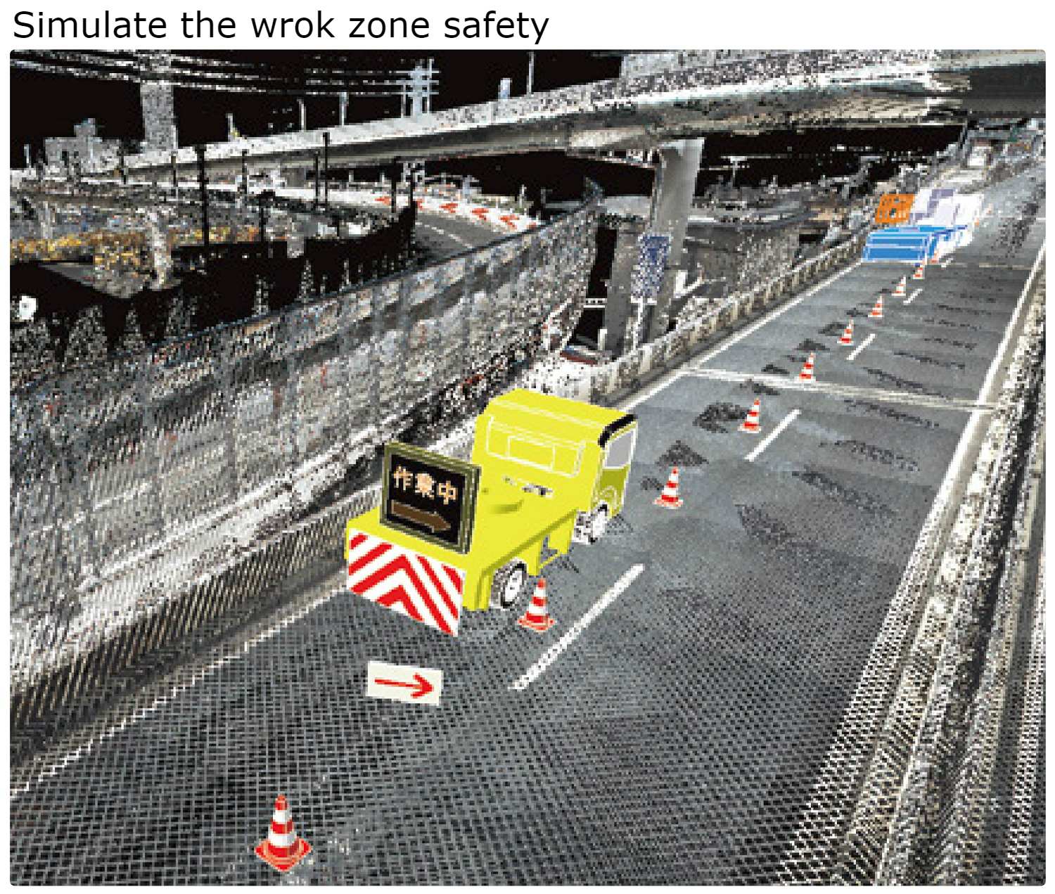
By utilizing GIS and 3D point cloud data, the extended functions of InfraDoctor provides advanced road infrastructure management. Such as creation of drawings, damage detection of pavement and wall surfaces; traffic control design for safety zone and 3D simulations.

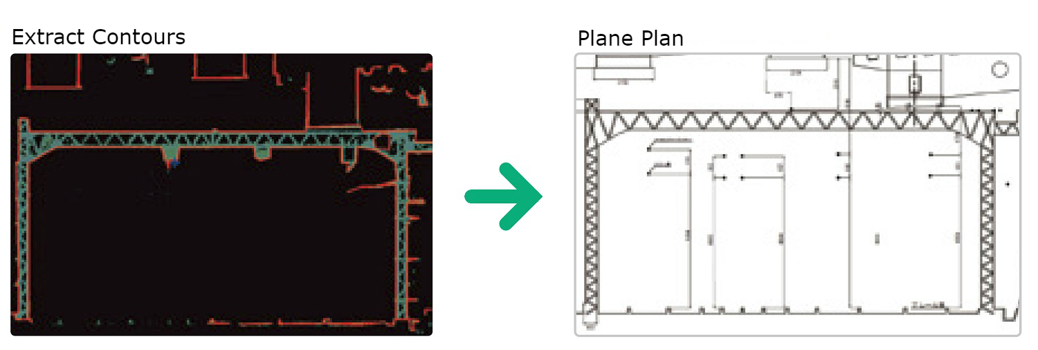
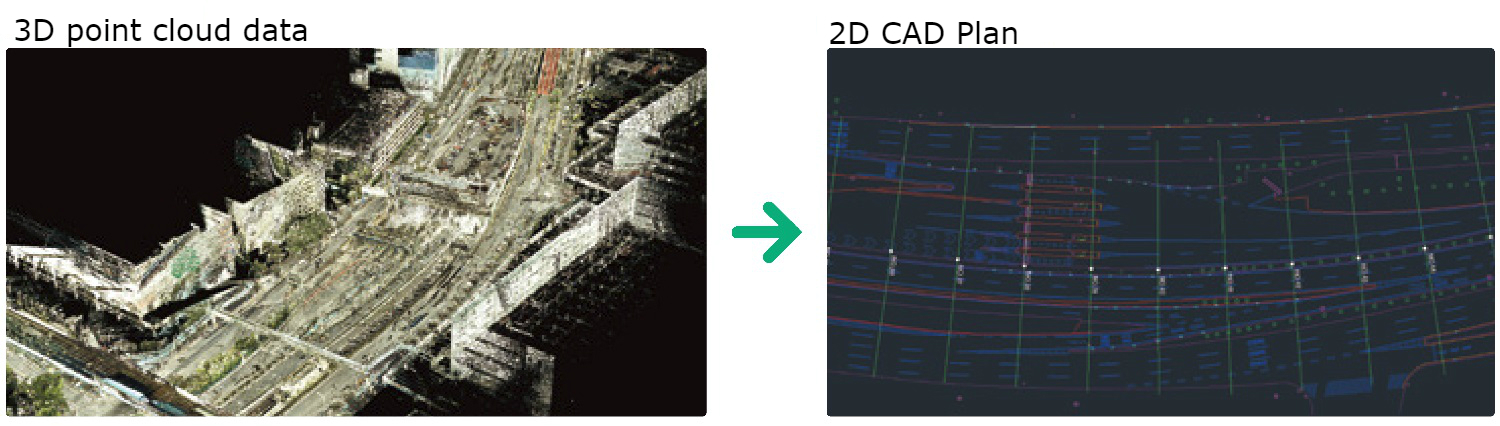
Function of 2D CAD drawing

With 3D point cloud data, cross section and plane plans can be drawn semi automatically. InfraDoctor is highly accurate, with cross section plan down to millimetre. And a developed plane plan is accurate in the scale of 1:500 (depending of GPS data conditions. A supplementary survey may be required to compensate the point cloud data.)

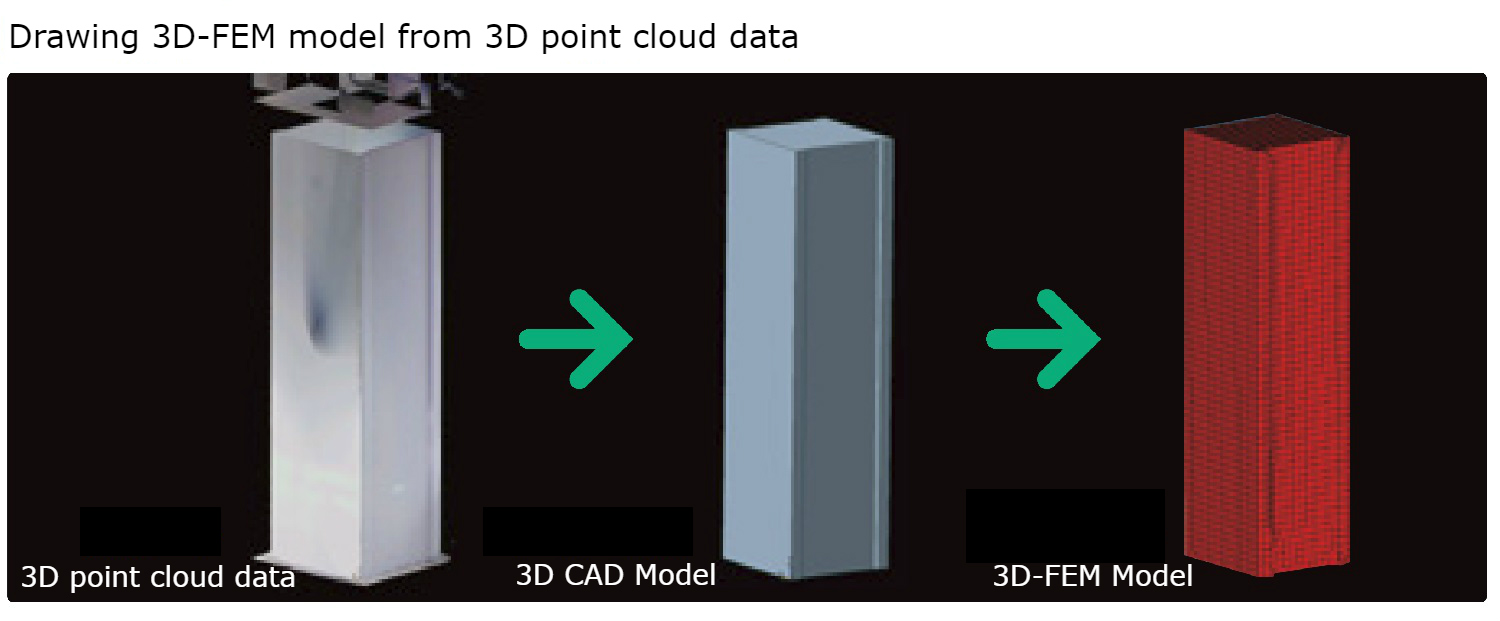
Function of 3D analysis model

InfraDoctor can also produce 3D CAD model semi automatically using 3D point cloud data.Utilizing a 3D CAD model, a 3D FEM analysis model can also be produced. Making this function very useful for CIM (Construction Information Management).

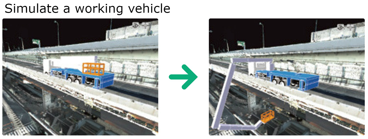
Inspection work vehicle simulation

3D point cloud data also allows simulation of work site traffic flow by mounting InfraDoctor on any suitable vehicle. This function makes efficient working at the site, because you can choose the working vehicle best suited to the task and check operations procedures and interference with obstacles.

Traffic control for safety work zone

By combining CAD traffic control data and 3D point could data, InfraDoctor can create traffic control plan semi automatically. It can also generate road simulation images from a driver’s view point, thus enabling realistic and efficient workflow.

Function of damage detection

Using 3D point cloud data, InfraDoctor can create a reference plane of pavements and structures which shows the differences between the reference planes and 3D point cloud data in a coloured diagram. This function is very useful for the first stage of inspection which can reveal rutting, potholes in pavements, flaking and peeling damage in concrete.